
From thousands of fields to one clear cane picture
What We Learned from Monitoring Thousands of Small Sugarcane Fields
For mills in densely populated areas, having a stable cane supply source on which to plan your daily, weekly and monthly production schedule, is not a given.
Fragmented plots, long travel distances, rainy conditions, and manual data uncertainty often make out the rules of managing an outgrower-based cane supply source in such systems, and can make it difficult to answer a seemingly simple question: how much cane will be available, where is it, and when will it be ready?
When a sugar mill depends on outgrowers for its raw material supply, two critical issues emerge: harvest timing and cane quality. The geographical dispersion makes effective monitoring by field teams both logistically complex and costly. Technicians must travel long distances to visit fields, engage with farmers, deliver agronomic advice, and coordinate harvesting schedules.
Compounding this challenge is the economic reality faced by smallholder growers. Due to the limited size of their landholdings, many engage in multiple livelihood activities, with sugarcane cultivation often treated as a secondary enterprise. As a result, agronomic practices may be neglected, pest and disease interventions delayed, and harvesting conducted at suboptimal times—all of which diminish cane quality and mill efficiency.
Finally, in the absence of robust verification mechanisms, ensuring the accuracy and reliability of manually entered field data remains a significant obstacle.
Could satellite monitoring work at this scale?
This was the problem that SmartCane was tasked with to solve. So, we created an application specifically designed to monitor sugarcane cultivation on small fields of less than one acre.
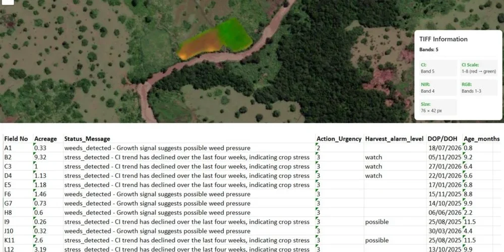
By combining high-frequency, high-resolution satellite imagery with per-pixel analysis, the service now addresses the technical challenges associated with monitoring small fields. Satellite images are captured on a daily basis, enabling weekly monitoring—even under challenging, cloudy conditions.
The 3 × 3 meter spatial resolution makes it possible to monitor small patches of sugarcane effectively. Non-cane elements, such as trees, roads, buildings, ponds, and footpaths, are identified and classified as either permanent or temporary features. These elements are subsequently excluded from the sugarcane analysis, ensuring more accurate monitoring results.
Per-pixel analysis enables the detection of anomalies at a highly granular level while removing non-cane elements at an early stage of the analysis. This approach also addresses challenges related to field-boundary accuracy and satellite-image displacement. As a result, SmartCane can reliably monitor fields smaller than one acre.
What has the impact been?
Real-time monitoring now provides actionable visibility into the volume of cane expected to arrive at the factory each week. This enables the factory to operate on a continuous, controlled, and well-planned basis, with operations aligned to the availability of cane. In effect, thousands of individual fields can be managed and coordinated as one integrated supply system.
At the same time, agronomic teams can consistently monitor cane quality and field conditions. Digital systems enable targeted, tailored communication with growers, while allowing field technicians to optimize their visits and travel routes according to the specific agronomic needs of each grower and field.
To conclude, the broader lesson for us has been that remote sensing is most useful when it reduces complexity rather than adding another layer of data.
A mill may depend on thousands of individually managed plots, but it does not necessarily have to manage them as thousands of disconnected information sources. With the right combination of satellite monitoring, field knowledge and digital communication, they can increasingly be understood and coordinated as one integrated cane supply system.
Sam signing of, from the field.